
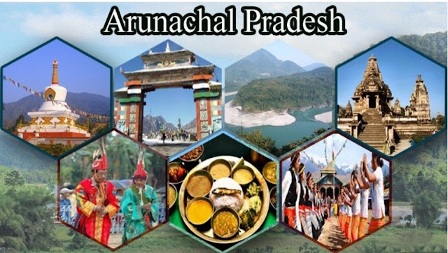
Nestled in the eastern Himalayas, Arunachal Pradesh is a mesmerizing tapestry of untouched wilderness and cultural diversity. With its mist-shrouded peaks, dense forests, and vibrant indigenous communities, this hidden gem of India beckons adventurous souls and cultural enthusiasts alike. Explore a land where time seems to stand still, where every corner reveals a new facet of nature’s grandeur and human resilience—Arunachal Pradesh: where the past meets the present in an embrace of natural and cultural wonder.
Let’s see all 23 places in detail.
1. Tawang
Map Location:- https://goo.gl/maps/jrdbrgormHT9YsJW8
Tawang district is the smallest of the 26 administrative districts of Arunachal Pradesh state in northeastern India. With a population of 49,977, it is the eighth least populous district in the country
2. Ziro
Map Location:- https://goo.gl/maps/B1zKXpwnAzJx7Zq68
Ziro is a town in and the district headquarters of the Lower Subansiri district in the Indian state of Arunachal Pradesh. It is included in the Tentative List for UNESCO’s World Heritage Site for the Apatani cultural landscape. The part of the town that is the center of economic activities and where the administrative offices are located is called Hapoli locally known by the Apatanis as “Hao-Polyang”. Ziro is 115 km from the state capital, Itanagar, 112 km from North Lakhimpur in Assam, and 96 km from Naharlagun railway station. Indian Air Force’s ALG airstrip is at Ziro.
3. Namdapha National Park
Map Location:- https://goo.gl/maps/SUaeP5pbds8PpqxS7
Namdapha National Park is a 1,985 km2 (766 sq mi) large protected area in Arunachal Pradesh of Northeast India. The park was established in 1983. With more than 1,000 floral and about 1,400 faunal species, it is a biodiversity hotspot in the Eastern Himalayas. The national park harbors the northernmost lowland evergreen rainforests in the world at 27°N latitude. It also harbors extensive dipterocarp forests, comprising the northwestern parts of the Mizoram-Manipur-Kachin rain forests ecoregion. It is the fourth-largest national park in India.
4. Sela Pass
Map Location:- https://goo.gl/maps/b2WUduPUonuYuq2RA
The Sela Pass is a high-altitude mountain pass located on the border between the Tawang and West Kameng districts in the Indian state of Arunachal Pradesh. It has an elevation of 4170 m (13,700 ft) and connects the Indian Buddhist town of Tawang to Dirang and Guwahati. The pass carries the National Highway 13 (previously NH 229), connecting Tawang with the rest of India. The pass supports scarce vegetation and is usually snow-covered to some extent throughout the year. Sela Lake, near the summit of the pass, is one of approximately 101 lakes in the area that are sacred in Tibetan Buddhism. While Sela Pass does get heavy snowfall in winter, it is usually open throughout the year unless landslides or snow require the pass to be shut down temporarily. Sela Pass is one of the highest motorable mountain passes in the world
5. Tezu
Map Location:-https://goo.gl/maps/y98SVPSjvNU5R76h9
Tezu is a census town and the headquarters of Lohit district in the Indian state of Arunachal Pradesh. It is the fifth-largest town in Arunachal Pradesh and one of its most developed. Tezu is one of the 60 constituencies of the Legislative Assembly of Arunachal Pradesh. The current MLA (May 2019) of the Tezu constituency is Karikho Kri. He is an independent candidate.
6. Roing
Map Location:- https://goo.gl/maps/wnC4Z96iCXpzYJdp7
Roing is the district headquarters of the Lower Dibang Valley district in the Indian state of Arunachal Pradesh. It is the last major township at the northeastern frontier of India.
7. Bomdila
Map Location:- https://goo.gl/maps/Edz4HYLXLD7smLS3A
Bomdila is the headquarters of West Kameng district in the state of Arunachal Pradesh in India. Bomdila is one of the 60 constituencies of the state of Arunachal Pradesh.
8. Dirang
Map Location:- https://goo.gl/maps/otUbJQb6hVrzoupz6
Dirang is a village in the district of West Kameng in the Indian state of Arunachal Pradesh. Dirang is one of the 60 constituencies of the Legislative Assembly of Arunachal Pradesh. The name of the current MLA (August 2019) of this constituency is Phurpa Tsering.
9. Pasighat
Map Location:- https://goo.gl/maps/cjhtZh4Dx2uQtkPv7
Pasighat is the headquarters of East Siang district in the Indian state of Arunachal Pradesh. Situated at the eastern foothills of the Himalayas at 155 meters (509 ft) above mean sea level, Pasighat is Arunachal’s oldest town. The Government of India included Pasighat in the Smart Cities Mission development scheme in June 2017.
10. Itanagar
Map Location:- https://goo.gl/maps/Pn26KbeyMsTtehDJA
Itanagar is the capital of the northeast Indian state of Arunachal Pradesh. Set in the foothills of the Himalayas, the city is home to medieval Ita Fort and the Jawaharlal Nehru State Museum, which exhibits textiles and handicrafts. The nearby Gompa, a yellow-roofed Buddhist temple, was consecrated by the Dalai Lama. West of town is Geker Sinying, also known as Ganga Lake, surrounded by forests, orchids and ferns.
11. Aalo
Map Location:- https://goo.gl/maps/tVnunFo94xx7r1mN9
Aalo, formerly Along, is a census town and headquarters of the West Siang district district of the Indian state of Arunachal Pradesh. It is located 137 kilometers from Likabali, which is at the border of Assam and Arunachal Pradesh. It is also an Advance Landing Ground of the Indian Air Force.
12. Nuranang Falls
Map Location:- https://goo.gl/maps/UTcz3K74Y6aKCoWK9
Nuranang Falls, a 100 m high waterfall, is located 2 km northeast of Jang town on the motorable Jang Falls Road in the Tawang district of Arunachal Pradesh state of India. Jang is 40 km southeast of Tawang, north of Sela Tunnel, and between Tawang and Bomdila on NH-13 Trans-Arunachal Highway.
13. Bhalukpong
Map Location:- https://goo.gl/maps/pUhrir28gg1XGo966
Bhalukpung is a small town located along the southern reaches of the Himalayas in the West Kameng district of Arunachal Pradesh in India. The town is located 213m above sea level, 100 km from Bomdila, 52 km from Tezpur, and 5 km from Tipi. It lies along the Kameng River and is the headquarters of Bhalukpung Circle.
14. Sangti
Map Location:- https://goo.gl/maps/zi7zAvbNZfsjHTz48
Sangti Valley is situated about 14 kilometers from Dirang. It is surrounded by the towering ranges of the Eastern Himalayas, blessed with pleasant weather round the year with maybe some light snowfall in the winter months, covered with fruit orchards (kiwi fruit, apple, apricot, orange), dotted with pristine forests and meandering fast hill rivers. It is also home to the black-necked cranes who come to the fields of this valley every winter.
15. Changlang
Map location:-https://goo.gl/maps/DNzj3z1qUU4CMHESA
Changlang is a census town and headquarters of the Changlang district in the Indian state of Arunachal Pradesh. It has become one of the major districts in the area owing to the presence of crude oil, coal, and mineral resources other than tourism and hydropower.
16. Bum La Pass
Map Location:- https://goo.gl/maps/CUHUANYJfNkwGrbQA
The Bum La Pass is a border pass between China’s Tsona County in Tibet and India’s Tawang district in Arunachal Pradesh. It is 37 km away from the town of Tawang in India’s Tawang district and 43 km from the town of Tsona Dzong in China’s Tsona County.
17. Mechukha
Map Location:- https://goo.gl/maps/8S6kmKiyoVDrrbaPA
Mechukha or Menchukha is a town, assembly constituency, and subdivision, situated 6,000 feet above sea level in the Mechukha Valley of Yargep Chu/ Siyom River in Shi Yomi district of Arunachal Pradesh state of India. Before the 1950s, Mechuka Valley was known as Pachakshiri.
18. Daporijo
Map Location:- https://goo.gl/maps/tvdgyDsF3Tw6Co2b9
Daporijo is a census town in the Upper Subansiri district, Indian state of Arunachal Pradesh in the Northeast of India.
19. Hayuliang
Map Location:- https://goo.gl/maps/toeQNyQs4ESVNKDJ6
Hayuliang is a town and the headquarters of an eponymous subdivision in the Anjaw district in the north-eastern state of Arunachal Pradesh, India. It is on the bank of the Lohit River near the confluence of the Delei River. The Hayuliang subdivision, administered by an additional divisional commissioner (ADC), covers the entire Delei River basin including the Hayuliang Circle, Metengliang Circle, Goiliang Circle, and the Chaglagam Circle. It is divided into two community development blocks, the Hayuliang–Goiliang block and the Chaglagam block. The region is populated by Mishmis, who speak Digaro Mishmi and Kaman Mishmi languages.
20. Pakke Tiger Reserve
Map Location:- https://goo.gl/maps/qtvvmBJqeFgxuvST6
Pakke Tiger Reserve is a Project Tiger reserve in the East Kameng district of Arunachal Pradesh in Northeast India. The 862 km² reserve is protected by the Department of Environment and Forest of Arunachal Pradesh. It was known as Pakhui Tiger Reserve but was renamed in April 2001 by the Governor of Arunachal Pradesh.
21. Gori Chen
Map Location:- https://goo.gl/maps/egWhC4FtDz5FXVmN9
Gori Chen is a glacier-fed mountain group in the Eastern Himalayas. Peaks include the third-highest peak in northeast India. Other peaks include Gorichen II (21,287 feet (6,488 m)), Gorichen East (20,413 feet (6,222 m)), and Gorichen South (20,496 feet (6,247 m)). It is among the mountains of India that are popular for expeditions and trekkers. Gori Chen provided training to the 19 Kumaon before its deployment in Siachen in the 1980s. Older expeditions passing Gori Chen include the Bailey–Morshead exploration in 1913 and Bill Tilman’s expedition in 1939. The Bailey–Morshead exploration in 1913 has inspired a modern Bailey Trail.
22. Sungester Lake
Map Location:- https://goo.gl/maps/inNjCiF4syg1rPfK8
The Sangestar Tso, formerly called Shonga-tser Lake and popularly known as the Madhuri Lake, is located on the way from Tawang to Bum La Pass in the Tawang district of Arunachal Pradesh, near the Indo-China border above 3,708 meters (12,165 ft) above sea level.
23. Golden Pagoda, Namsai
Map Location:- https://goo.gl/maps/61N1ipwW8FoEicbFA
The Golden Pagoda of Namsai, also known as Kongmu Kham, in the Tai-Khamti language, is a Burmese-style Buddhist temple that was opened in 2010. It is located on a 20-hectare (49 acres) complex in the Namsai District of Arunachal Pradesh, India, and at a distance of 68 km (42 mi) from the nearest railway station Tinsukia, Assam. A sum of 3 crores was spent by Arunachal politician Chowna Mein, the local MLA in building the pagoda in a plot provided by the state government. The World Tripiṭaka Foundation is currently developing Kongmu Kham as the first international Tripiṭaka center in India.
I hope this information is useful to you while your travel to Arunachal Pradesh,
Thank You Very Much.
Disclaimer:
The information provided on this website is for general informational purposes only. While we strive to keep the information accurate and up to date, we make no representations or warranties of any kind, express or implied, about the completeness, accuracy, reliability, suitability, or availability concerning the website or the information, products, services, or related graphics contained on the website for any purpose.
Any reliance you place on such information is therefore strictly at your own risk. We do not guarantee the accuracy, timeliness, performance, completeness, or suitability of the information and materials found or offered on this website for any particular purpose. You acknowledge that such information and materials may contain inaccuracies or errors and we expressly exclude liability for any such inaccuracies or errors to the fullest extent permitted by law.
In no event will we be liable for any loss or damage including without limitation, indirect or consequential loss or damage, or any loss or damage whatsoever arising from loss of data or profits arising out of, or in connection with, the use of this website.
Through this website, you may be able to link to other websites that are not under our control. We have no control over the nature, content, and availability of those sites. The inclusion of any links does not necessarily imply a recommendation or endorse the views expressed within them.
Every effort is made to keep the website up and running smoothly. However, we take no responsibility for, and will not be liable for, the website being temporarily unavailable due to technical issues beyond our control.
The information provided on this website is not intended to replace or substitute professional advice. It is advisable to seek the advice of qualified professionals regarding specific situations or circumstances.
We reserve the right to modify, update, or remove any information on this website without prior notice.