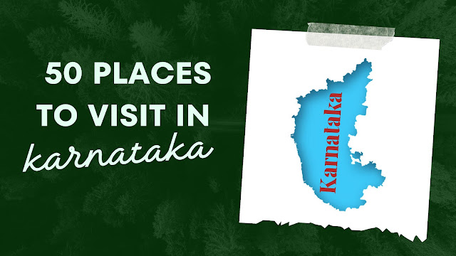
Karnataka, a vibrant state in southern India, is a captivating tapestry of rich culture, history, and natural beauty. Renowned for its diverse landscapes, Karnataka boasts pristine beaches along the Arabian Sea, lush forests in the Western Ghats, and expansive plains dotted with historical marvels. The state’s glorious past is etched in its ancient temples, royal palaces, and impressive monuments, showcasing the architectural brilliance of various dynasties that have left their mark on the region. Karnataka is also a hub of modernity, with bustling cities like Bengaluru leading the charge in technology and innovation. The warmth and hospitality of its people, along with a delectable cuisine that tantalizes taste buds, make Karnataka an inviting destination for travelers seeking a blend of tradition and progress.
Now Let’s Find Out 50 places in Karnataka we divided into Different Categories so check out the list and find out what you really wanna do in Karnataka and then explore the places, we tried to give you traveling spots along with map locations so we hope this list will help you in your trip planning,
There are a total of 9 Categories and those are as follows
1. Historical Places
2. Eco- Tourism Places
3. Adventure places
4. Beaches
5. Museums
6. Theme Parks
7. Garden and parks
8. Hill Stations
9. Spiritual Places
Let’s see everything in Detail
⭐Historical Places In Karnataka
1. Hampi
Map Location:- https://goo.gl/maps/T42969gin9YJDPbH7
Hampi is an ancient village in the south Indian state of Karnataka. It’s dotted with numerous ruined temple complexes from the Vijayanagar Empire. On the south bank of the River Tungabhadra is the 7th-century Hindu Virupaksha Temple, near the revived Hampi Bazaar. A carved stone chariot stands in front of the huge Vittala Temple site. Southeast of Hampi, Daroji Bear Sanctuary is home to the Indian sloth bear.
2. Badami
Map Location :- https://goo.gl/maps/Kk2DWJz2ea4gc4ez6
Badami, formerly known as Vātāpi, is a town and headquarters of a taluk by the same name, in the Bagalkot district of Karnataka. It was the regal capital of the Badami Chalukyas from 540 to 757. It is famous for its rock-cut monuments such as the Badami cave temples and structural temples such as the Bhutanatha temples, Badami Shivalaya, and Jambulingesvara Temple. It is located in a ravine at the foot of a rugged, red sandstone outcrop that surrounds Agastya Lake.
3. Mysore
Map Location:- https://goo.gl/maps/DDkLfPSac628zSUdA
Mysore (or Mysuru), a city in India’s southwestern Karnataka state, was the capital of the Kingdom of Mysore from 1399 to 1947. In its center is the opulent Mysore Palace, the seat of the former ruling Wodeyar dynasty. The palace blends Hindu, Islamic, Gothic, and Rajput styles. Mysore is also home to the centuries-old Devaraja Market, filled with spices, sil,k and sandalwood.
4. Aihole
Map Location:- https://goo.gl/maps/G1MgGg7hoqNxbDBQ8
Aihole also referred to as Aivalli, Ahivolal, or Aryapura, is a historic site of ancient and medieval era Buddhist, Hindu, and Jain monuments in Karnataka, India that dates from the sixth century through the twelfth century CE. Most of the surviving monuments at the site date from the 7th to 10th centuries.
5. Bider
Map Location:- https://goo.gl/maps/XoBi7v9jdFLyQpee7
Bidar is a city in the north-eastern part of Karnataka state in India. It is the headquarters of Bidar district, which borders Maharashtra and Telangana. It is a rapidly urbanizing city in the wider Bidar Metropolitan area. The city is well known for its many sites of architectural, historical, and religious importance. Bidar City has a population of more than 2 lakh and are likely to get upgraded to municipal corporation in the next 5 years.
6. Pattadakal
Map Location:- https://goo.gl/maps/Szmnu7bYsTYnPmTz9
Pattadakal, in Karnataka, represents the high point of eclectic art which, in the 7th and 8th centuries under the Chalukya dynasty, achieved a harmonious blend of architectural forms from northern and southern India. An impressive series of nine Hindu temples, as well as a Jain sanctuary, can be seen there.
7. Bijapur
Map Location:- https://goo.gl/maps/qN4pXzja4CQL7jmo9
Bijapur, officially known as Vijayapura, is the district headquarters of Bijapur district of the Karnataka state of India. It is also the headquarters for Bijapur Taluk. Bijapur city is well known for its historical monuments of architectural importance built during the rule of the Adil Shahi dynasty. It is also well known for the sports by the popular Karnataka premier league team as Bijapur Bulls. Bijapur is located 530 km (330 mi) northwest of the state capital Bangalore and about 550 km (340 mi) from Mumbai and 384 km (239 mi) west of the city of Hyderabad.
⭐Eco-Tourism Places
8. St. Mary’s Islands
Map Location:- https://goo.gl/maps/RFZMV8QLCW8NjM3cA
St. Mary’s Islands, also known as Coconut Island and Thonsepar, are a set of four small islands in the Arabian Sea off the coast of Malpe in Udupi, Karnataka, India. They are known for their distinctive geological formation of columnar rhyolitic lava (pictured). Scientific studies indicate that the basalt of the St. Mary’s Islands was formed by a sub-aerial subvolcanic activity because at that time Madagascar was attached to India. The rifting of Madagascar took place around 88 million years ago.
9. Nandi Hills
Map Location:- https://goo.gl/maps/ytUiTJxWEgJ2khaAA
Nandi Hills, or Nandidurg, is a hill fortress in the south Indian state of Karnataka. Tipu Sultan Fort, a summer retreat of the namesake 18th-century ruler, features stone carvings and wall paintings. Prisoners are said to have been thrown to their deaths from Tipu’s Drop, now known for its panoramic views. Local Hindu temples include the hilltop Yoga Nandeeshwara Temple, guarded by a huge statue of a bull (Nandi).
10. Nilakandi falls
Map Location:- https://goo.gl/maps/AtgLFAaaMQ8yTkXK8
The Nilakandi Falls is set amidst the dense tropical forests of Coorg and starts somewhere in the Thadiyandamol range. Cascading down from a height of about 50 feet, it is a picturesque and serene waterfall that lends trekkers a wonderful waterfall shower experience. This place is one of the few tourist places in Coorg that portray the enchanting beauty of this lovely destination. Do plan a visit to this waterfall if you want to plunge into the natural beauty of Coorg.
11. Bandipur National Park
Map Location:- https://goo.gl/maps/sK6emUkkEzyjwvbZ6
Bandipur National Park, an 874-sq.-km forested reserve in the southern Indian state of Karnataka, is known for its small population of tigers. Once the private hunting ground of the Maharajas of Mysore, the park also harbors Indian elephants, spotted deer, gaurs (bison), antelopes, and numerous other native species. The 14th-century Himavad Gopalaswamy Temple offers views from the park’s highest peak.
12. Nagarahole Tiger Reserve
Map Location:- https://goo.gl/maps/3WpRdiecuzjXiwJz6
Nagarhole National Park, also known as Rajiv Gandhi National Park, is a wildlife reserve in the South Indian state of Karnataka. Part of the Nilgiri Biosphere Reserve, the park is backed by the Brahamagiri Mountains and filled with sandalwood and teak trees. The Kabini River winds through jungle landscapes, home to tigers, Asian elephants, and a variety of birds. Nearby, the Irupu Falls cascade down tree-lined rocks.
13. Jog falls
Map Location:- https://goo.gl/maps/CvvKsfim6T2oh4dS8
Jog is a village located in Shivamogga district of Karnataka state, India. The Jog Falls is near this village.
⭐ Adventurous Places
14. kodachi Hills
Map Location:- https://goo.gl/maps/6v4uuHFxUY2ievdU9
Kodachadri is a mountain peak with dense forests in the Western Ghats in South India, 78 km from Shimoga. Kodachadri is the highest peak in Shivamogga district. It is declared a natural heritage site by the Karnataka Government. and it is the 13th-highest peak in Karnataka.
15. Dandeli
Map Location:- https://goo.gl/maps/no9C3r4Zg4MfofZM6
Dandeli is a town in the western Indian state of Karnataka. The Dandeli Wildlife Sanctuary, with its trails and dense forests, is home to animals including black panthers, monkeys, and elephants, as well as many bird species. A temple stands at the entrance to the limestone Kavala Caves, known for their stalagmite formations. West of the caves, Anshi National Park encompasses the Kali Tiger Reserve.
16. Netrani Island
Map Location:- https://goo.gl/maps/tRbDxt6hWRVHtHBY8
Netrani (historically known as Bajrangi Island, Pigeon Island, and also Heart Shaped Island)is a small island in India located in the Arabian Sea. It is mostly famous for Jai Bajrangbali Temple, an ancient Hindu Temple. It is off the coast of Karnataka situated approximately 10 nautical miles (19 km) from the temple town of Murudeshwara in Bhatkal Taluka. The island can be seen from the mainland over 15 km (9.3 miles) away. Views above give this island the appearance of being heart-shaped. Its animal inhabitants include wild goats and pigeons. It has scuba diving facilities and is easily accessible from Bhatkal, Mangalore, Goa, Mumbai, or Bangalore. There are dive shops at Murdeshwara and Goa that regularly organize trips to the island. It is known locally as Nitra Gudo. The famous Hindu temple Jai Bajrangbali Temple is located here.
17. kumara parvatha trek
Map Location:- https://goo.gl/maps/CheZ4Pt3yGKSKfU96
Kumara Parvatha is not just a trek it’s one of those journeys in life that one must embark upon to truly be one with nature and themselves. Located in Kodagu/Coorg district at an elevation of 5600ft its second highest peak in the state, after Tadiyandamol. The mountain lies behind the famous Kukke Subramanya temple. A small gate and board act as indicators of the trekking trail that stands behind them.
⭐ Beaches to Visit
18. Tilmati Beach(black sand beach)
Map Location:- https://goo.gl/maps/j6n8kVM4GadWazse6
The Tilmati beach in Karwar is located in Uttara Kannada district of Karnataka. The sand here looks like black sesame, which is why the beach is named Tilmati. The name comes from the Konkani word ’till’ which means sesame seeds and ‘matti’ which means soil
19. Om Beach
Map Location:- https://goo.gl/maps/Bwhtmh4FTjqD8mW37
One of the most acclaimed beaches in the country, Om Beach takes the shape of an ‘Om’, a Hindu spiritual symbol. In the shape of two crescents joined together to form an Om, the beach offers a breathtaking view of the sunset.
20. kapu beach
Map Location:- https://goo.gl/maps/4vNeQd9aJkjnK8HZA
Kapu is a beach village in coastal Karnataka. Kapu’s long sandy beaches offer a panoramic view of the Arabian Sea. With its tropical climate and a bevy of attractions that beckon tourists from across the country, Kapu is predominantly known for its greenery that surrounds the beach. One of the main attractions of Kapu Beach is the century-old 130 ft. lighthouse. Other must-see spots in Kapu include the two temples of Goddess Mariamma and the Jain Basadis.
21. Panambur beach
Map Location:- https://goo.gl/maps/nkohEeLnujtNafRJA
Tranquil beach features a broad stretch of sand & a lighthouse with views from the top.
22. Someshwar Beach
Map Location:- https://goo.gl/maps/qSVorN59SisjmC1s6
Someshwar Beach is a beach located in Ullal in the city of Mangalore, India. The name ‘Someshwara Beach’ is derived from the name of Lord Somanatha, whose temple is located on the seashore dating back centuries.
23. Tannirbhavi beach
Map Location:- https://goo.gl/maps/c82zy6noRkahSFcR7
Tannirbhavi Beach is a beach in Mangalore, Karnataka, India. It is one of the most popular tourist destinations in coastal Karnataka. Along with the beach, Sultan Battery, Tannirbavi Tree Park & the proposed Marine Museum are also tourist attractions. It can be reached either by land near Kuloor Bridge or by ferry via Gurupura River from Sultan Battery.
⭐ Museums – If you love history
24. HAL (Heritage Centre and Aerospace Museum)
Map Location:- https://goo.gl/maps/hRrk7S8L8UiCHxiXA
HAL Aerospace Museum is India’s first aerospace museum located at Hindustan Aeronautics Limited premises, in Bangalore. Established in 2001, the Museum is part of the HAL Heritage Centre and Aero Space Museum and showcases the growth of the Indian aviation industry and HAL for six decades.
25. Sandalwood Museum
Map Location:- https://goo.gl/maps/kn8arhXDJLxECp8m8
Mysuru is not only famous for its Pak and Yoga but also for the wide range of Sandalwood Products that the city sells like oils, soaps, incense sticks, artifacts, etc. Now, visitors can learn about the history and cultivation of Sandalwood Products, all thanks to India’s first Sandalwood Museum which is coming up in Mysuru. According to the Deputy Conservator of Forests, Dr. K C Prashant Kumar, the Museum is being set up by the Regional Forest Department in an area of 17 meters x 8 meters and most of the work has been completed. He also stated that the Museum will display different types of Sandalwood, Billets, and Dusts of Sandalwood. Posters containing information about Sandalwood growing and the prevention of diseases and a 3D Model of Sandalwood Sculpture would also be displayed.
26. Government Museum
Map location:- https://goo.gl/maps/P7UbomGjEgFytS2f7
Government Museum, Bangalore, established in 1865 by the Mysore State with the guidance of Surgeon Edward Balfour who founded the museum in Madras and supported by the Chief Commissioner of Mysore, L.B. Bowring, is one of the oldest museums in India and the second oldest museum in South India.
27. INS Chapal Warship Museum (K94)
Map Location:- https://goo.gl/maps/fd5P26daCRbToLxQ9
Beachside history museum inside an old warship featuring a video & exhibits on the Indian Navy.
28. Jaganmohan Palace Art Gallery And Auditorium
Map Location:- https://goo.gl/maps/VBuD8vXmaZGDfxVKA
Sri Jayachamarajendra Art Gallery, commonly known by its former name Jaganmohana Palace, is a royal mansion, art museum, and auditorium, and formerly an alternative royal residence of the ruling maharaja of Mysore, located in Mysore, India, about 200m to the west of Mysore Palace.
⭐Theme park
29. Lumbini Garden
Map Location:- https://goo.gl/maps/5Xxt2bsvUcPC1iAM7
Lumbini Gardens is a public park on the banks of the Nagawara Lake in Bangalore, Karnataka named after Lumbini of Nepal. It is dedicated to Lord Budhha. Although the garden is mainly a national park, it is a treat to the eyes with its serene landscapes and lots of greenery.
30. Wonderla Amusement Park
Map Location:- https://goo.gl/maps/98Kn2p7ZVFrYJr6U8
Amusement park with roller coasters, a Ferris wheel & water rides, plus virtual reality experiences.
31. Snow City Bengaluru
Map Location:- https://goo.gl/maps/NdVkcxw9zNY9natk7
Ice & snow-themed indoor amusement park featuring frozen slides, rides & other family activities.
⭐Gardens and parks
32. Brindavana Gardens
Map Location:- https://goo.gl/maps/LATxphLqpZLrQN7S9
The Brindavan Gardens is a garden located 12 km from the city of Mysore in the Mandya District of the Indian State of Karnataka. It lies adjoining the Krishnarajasagara Dam which is built across the river Kaveri. The work on laying out this garden was started in the year 1927 and completed in 1932.
33. Cubbon Park
Map Location:- https://goo.gl/maps/cDYJm42iGfaBbow59
Cubbon Park, officially Sri Chamarajendra Park, is a landmark park in Bengaluru, located in the heart of the city in the Central Administrative Area. Created in 1870 under Major General Richard Sankey, then British Chief Engineer of Mysore State, it covered an area of 100 acres.
34. Lalbagh Botanical Garden
Map Location:- https://goo.gl/maps/qeRnqXN2ndfrpChs9
Lalbagh Botanical Garden or simply Lalbagh, is a botanical garden in Bangalore, India, with an over 200-year history. First planned and laid out during the dalavaiship of Hyder Ali, the garden was later managed under numerous British Superintendents before Indian Independence.
35. Dodda Aalada Mara(Big Banyan Tree)
Map Location:- https://goo.gl/maps/LoEXpNvPVzkutzwV8
The Dodda Alada Mara, literally translated to Big Banyan Tree, is a giant approximately 400-year-old banyan tree located in the village of Kethohalli in the Bangalore Urban district of Karnataka, India. This single plant covers 3 acres and is one of the largest of its kind.
⭐Hill Stations
36. Coorg (Kodagu)
Map Location:- https://goo.gl/maps/a4dBfzJMG2e2Hku4A
Located amidst imposing mountains in Karnataka with a perpetually misty landscape, Coorg is a popular coffee-producing hill station. It is popular for its beautiful green hills and the streams cutting right through them. It also stands as a popular destination because of its culture and people. The Kodavas, a local clan specializing in martial arts, are especially notable for their keen hospitality.
37. Kudremukh
Map Location:- https://goo.gl/maps/sUJ1XaDz2w2e2tgK9
Kudremukha is the name of a mountain range and an individual mountain peak located in Chikmagaluru district, in Karnataka, India. It is also the name of a small hill station and iron ore-mining town situated near the mountain, about 20 kilometers from Kalasa in Kalasa Taluk.
38. Sakleshpura
Map Location:- https://goo.gl/maps/7Q9ashZo9rkmaioD9
Sakleshpur is a hill station in the Western Ghats mountain range, in India’s Karnataka state. It’s surrounded by slopes covered with tea, coffee, and spice plantations. The 18th-century, star-shaped Manjarabad Fort has sweeping mountain views. Trails lead to the biodiverse Bisle Reserve Forest, home to cobras, deer, and birds. To the northeast, Jenukallu Gudda Peak offers vistas stretching as far as the Arabian Sea.
39. Agumbe
Map Location:- https://goo.gl/maps/7zLL9ze1j7VSxC6s9
Agumbe is a high-altitude village in the southwest Indian state of Karnataka. Surrounded by the Western Ghats mountains and lush rainforest, it’s known for its many waterfalls, such as Onake Abbi, Bakarna and Jogi Gundi Falls. The Sunset View Point overlooks forested valleys. Nearby is Sri Venugopala Krishna Swamy Temple. To the south, tigers, leopards, and king cobras live in Someshwara Wildlife Sanctuary.
40. Chikkamagaluru
Map Location:- https://goo.gl/maps/sBPan6y8PCqbGvfaA
Chikmagalur is a hill station in Karnataka, a state in southwest India. To the north is Baba Budangiri, a mountain range in the Western Ghats, with 3 large caves said to be holy. Trails through forests and grasslands lead up to Mullayanagiri Peak. The cascading Hebbe Falls lie in an area of coffee plantations. The forested Bhadra Wildlife Sanctuary, northwest of Chikmagalur, is home to elephants, tigers and leopards.
41. Kemmangundi
Map location:- https://goo.gl/maps/CfpbJvtuqySVhPW9A
Known for its vibrant night sky vistas from atop the Kemmangundi Sunset View Point, Kemmangundi is a tranquil rural area surrounded by forest. It’s home to scenic hiking trails set along lush, rolling hills leading to sites like Shanti Falls and the popular Z Point Trekking Peak, as well as picturesque valley views from Krishnarajendra Botanical Park. There’s a simple hotel with a café set among terraced grounds.
⭐Spiritual Places
42. Kadri Shree Manjunatha Temple
Map Location:- https://goo.gl/maps/5yLXQLXJVttvNXaYA
The temple of Manjunatheshwara on the hills of Kadri is said to have been built during the 10th or 11th century. It was converted to a complete stone structure during the 14th century. The bronze (panchaloha) idol of Lokeshwar (identified as Brahma), about 5 feet high, of the temple is called as oldest of the South Indian temples. It has an inscription dated 968 A.D. (or 1068 A.D.), engraved on the pedestal. The inscription states that King Kundavarma of the Alupa Dynasty installed the Lokeshwara idol in Kadarika Vihara. It mentions Mangalore as “Mangalapura”. The image has three faces and six arms and holds and hold flowers in two of the arms. The crown depicts a Dhyani Buddha. The image has an ornate prabhavali and two attendants. It is very well preserved with enameled eyes. There exist two other undated bronze images of similar craftsmanship, one of them is identifiable as an Avalokiteshwar (called Narayana) and the other as Buddha (called Vedavyasa). Another stone inscription in Tulu, Kannada, and Malayalam scripts of 12-13th century A.D., in the temple’s kitchen, states that the ruler and the local landlords contributed land for the temple. A 1730 AD text Kadli Manjunath Mahatmyam gives an account of the association with Natha Mantha.
43. Murdeshwar
Map Location:- https://goo.gl/maps/kdGXNpKpiJAALyJr5
The origin of the name “Murdeshwar” dates to the time of Ramayana. The Hindu gods attained immortality and invincibility by worshiping a divine Linga called the Atma-Linga. The Lanka King Ravana wanted to attain immortality by obtaining the Atma-Linga (Soul of Shiva). Since the Atma-Linga belonged to Shiva, Ravana worshipped Shiva with devotion. Pleased by his prayers, Shiva appeared before him and asked him what he wanted. Ravana asked for the Atma-Linga. Shiva agreed to give him the boon on the condition that it should never be placed on the ground before he reaches Lanka. If the Atma-Linga was ever placed on the ground, it would be impossible to move it. Having obtained his boon, Ravana started back on his journey to Lanka.
44. Udupi Sri Krishna Temple, Alappuzha
Map Location:- https://goo.gl/maps/wWjgp8CpJBZ1nyPt5
The Krishna Matha was founded by the Vaishnavite saint Jagadguru Shri Madhvacharya in the 13th century. He was the founder of the Dwaita school of Vedanta. It is believed that Madhwacharya found the vigraha of Shri Krishna in a large ball of gopichandana. As told by Sri Madhvacharya, in his Tantrasara Sangraha, the Vigraha is placed in Pashchimabhimukha (facing west). All the other Vigrahas in other Ashta Muthas face west as well. Devotees always have the darshan of Lord Krishna through the inner window, known as the Navagruha Kindi & the outer window known as the Kanakana Kindi, which is decorated by an arch named after the great saint Kanakadasa. A statue has also been erected. A similar window covers the immediate front of the Vigraha and is called Navagraha Kindi. It is often mistaken to be the Kanakuna Kindi.
45. Omkareshwar Temple
Map Location:- https://goo.gl/maps/khrYKrs3zL3HVxU48
The Omkareshwara Temple is an ancient shrine dedicated to lord shiva, It is situated in the town of Madikeri in Coorg, Karnataka. The specialty of the temple is that its construction reflects a combination of Gothic and Islamic styles. It is a popular religious destination of Coorg.
46. St.Philomena’s Cathedral
Map Location:- https://goo.gl/maps/kfC1MgmGe1mdZgs79
St. Philomena’s Cathedral is a Catholic church that is the cathedral of the Diocese of Mysore, India. The full name is the Cathedral of St. Joseph and St. Philomena. It is also known as St. Joseph’s Cathedral.It was constructed in 1936 using a Neo-Gothic style and its architecture was inspired by the Cologne Cathedral in Germany. This is one of the tallest churches in Asia.
47. Jamiya Masjid
Map Location:- https://goo.gl/maps/aAWH7zcsAHVCkTsm6
The Jama Masjid of Bijapur is a congregational mosque in the Indian state of Karnataka. Initiated by Ali Adil Shah I of the Bijapur Sultanate in the 16th century, the mosque was never completed. It is the largest mosque in Bijapur and has a capacity of 4000 worshippers.
48. Gommatagiri
Map Location:- https://goo.gl/maps/iasNyMewuLrNaQeu5
Gommatagiri is an acclaimed Jain center. The 700-year-old statue of Bahubali (also known as Gomateshwara) is erected atop a 50-meter tall hillock called ‘Shravana Gudda’. The statue of Gomateshwara at Gommatagiri is an early Vijayanagara creation in granite. It has serene facial expressions and curly hair. This Jain center attracts many pilgrims during the annual “Maha masthakabhisekha” in September. The local Jains have a belief that the entire region was a bastion of Jainism at least since the 2nd Century BC.
49. Dharmasthala
Map Location:- https://goo.gl/maps/HbvE976tyvNejSLt8
Dharmasthala is a town in the southwest Indian state of Karnataka. The centuries-old Sri Manjunatha Temple, dedicated to Lord Shiva, is a place of Hindu pilgrimage known for its large statue of the revered figure Bahubali. The Manjusha Museum’s eclectic collection includes manuscripts and early wooden chariots. Nearby, the Car Museum features vintage automobiles, including a 1920s Studebaker used by Mahatma Gandhi.
50.Saavira Kambada Basadi (Thousand Pillars Temple)
Map Location:- https://goo.gl/maps/ALiidyF1Xd33ZjTf9
Saavira Kambada Temple or Tribhuvana Tilaka Cūḍāmaṇi, is a basadi or Jain temple noted for its 1000 pillars in Moodabidri, Karnataka, India. The temple is also known as “Chandranatha Temple” since it honors the tirthankara Chandraprabha, whose eight-foot idol is worshipped in the shrine.
I hope this information will help you in your next trip planning in Karnataka.
Thank You So much.
Disclaimer:
The information provided on this website is for general informational purposes only. While we strive to keep the information accurate and up to date, we make no representations or warranties of any kind, express or implied, about the completeness, accuracy, reliability, suitability, or availability with respect to the website or the information, products, services, or related graphics contained on the website for any purpose.
Any reliance you place on such information is therefore strictly at your own risk. We do not guarantee the accuracy, timeliness, performance, completeness, or suitability of the information and materials found or offered on this website for any particular purpose. You acknowledge that such information and materials may contain inaccuracies or errors and we expressly exclude liability for any such inaccuracies or errors to the fullest extent permitted by law.
In no event will we be liable for any loss or damage including without limitation, indirect or consequential loss or damage, or any loss or damage whatsoever arising from loss of data or profits arising out of, or in connection with, the use of this website.
Through this website, you may be able to link to other websites that are not under our control. We have no control over the nature, content, and availability of those sites. The inclusion of any links does not necessarily imply a recommendation or endorse the views expressed within them.
Every effort is made to keep the website up and running smoothly. However, we take no responsibility for, and will not be liable for, the website being temporarily unavailable due to technical issues beyond our control.
The information provided on this website is not intended to replace or substitute professional advice. It is advisable to seek the advice of qualified professionals regarding specific situations or circumstances.
We reserve the right to modify, update, or remove any information on this website without prior notice.
By using this website, you agree to the terms of this disclaimer. If you do not agree with any part of this disclaimer, please do not use our website.